
TNC Property BioBlitz - Water Group Report
April 12, 2024
by Laura Madden, Geoff Stillwell, and Joanne Keay
Introduction
Four St. Louis area master naturalists and two staff from The Nature Conservancy (TNC) conducted a Bio-Blitz on the TNC O’Fallon Land Trust Property, April 12, 2024. The property is at 2120 Lindsay Lane, O’Fallon, Mo.
The task assigned to the water group by TNC was to make observations on the physical conditions of a small woodland watershed into which the more elevated upland fields drain. The watershed included a sloped area leading down into a floodplain of Peruque Creek. The main task was to assess the condition of the watershed to inform watershed improvement planning. The group also noted the presence of flora and fauna as indicators of native or invasive conditions.
The observational trek was about a mile around this woodland section of the watershed. Elevations varied from about 530 to 600 feet. The trek took approximately 2.5 hours and proceeded counterclockwise through the watershed starting just south of the man-made pond. A small channel was observed to leave/enter the property (probably connecting to the creek) just beyond where the agricultural channel entered the woodland area. We were not sure if it was a source or sink. The channel/creek left the property at the base of sloped area leading from the pond.


Observations
During the survey, we thought the floodplain drainage channels became mixed and inseparable with the creek and that the creek water flows eastward, eventually onto the adjacent property. In the next map it is apparent that the ag channel wanders around in the floodplain and joins the creek where it meanders, joins, and crosses intermittently along the northern property line.
Peruque Creek enters the property from an adjacent property, near where the ag drainage channels enter the woodland area.
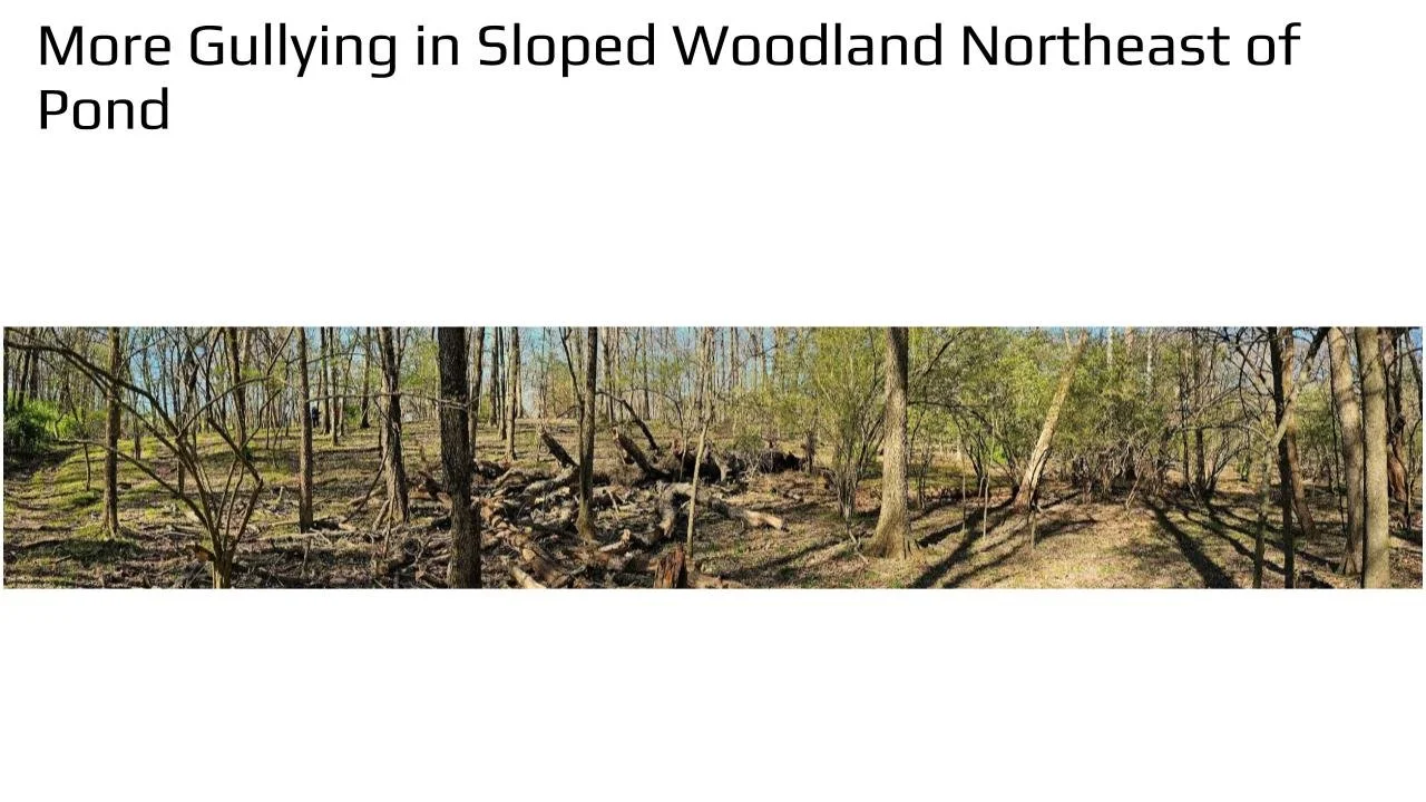
There is evidence of much gullying on the sloped woodland band across the watershed north of the pond (probably erosion).
Gullying and channel connection to the creek is very confusing in the western two-thirds of the lower elevation floodplain.
The soil seems to be denuded of vegetation and loose in many sloped and channel sides probably due to access by cattle (evidence in photos).
It is believed that erosion and gullying may be worse in floodplain due to full velocity of drainage, loosened soils, and lack of groundcover.
The pond discharge needs attention. There is probably little point in keeping cattle out of the pond but letting the pond discharge flow over the muck in the cattle area.
There was little observed aquatic or plant/algae life in or directly connected to the stream — only one frog was seen along the forested creek area. We turned over four rocks in the creek during our trek and found no evidence of macroinvertebrates.
Adjacent properties are significantly overgrown with honeysuckle and wild rose vines, while these invasives may be controlled by the presence of cattle movement.
There is some evidence of beneficial tree and shrub growth with serviceberry and verbena present.
Recommendations
Field observations were transferred to a USGS terrain map (above) to verify observations. While the trek was along existing fence lines, the authors are aware that fences do not represent actual property lines and would encourage TNC to check the legal property boundaries.
Drainage from the pond should be conveyed to the cattle-free sloped woodland area through a protected channel, separate and fenced from cattle area.
Cattle should be fenced out of or prevented from entering drainage, sloped, or floodplain channels. There is evidence of great damage from cattle and upland erosion throughout the woodland.
An analysis of improving the hydrology is possible, but will require a better delineation of the various gullies and actual creek channels throughout the floodplain and sloped woodlands. It might be possible to add Lidar elevation data to update and refine the surficial map and discern eroded drainage channels and creek channels. If the definition of this method is not adequate, it may be possible to contract a company for drone Lidar surveys.
A map that portrays the detailed elevation surface underlying the watershed woodland canopy is required for planning and understanding the mixture of natural drainage in the watershed area. The map is not adequate for site planning as data may be old (and DEM data is not as accurate as Lidar). An accurate current map is required.
Once plan might be to collect sloped drainage in swales to slow water and discharge into flow through wetlands, before discharging into the creek. This would eliminate the gullies and rapidly moving water from most of the drainage. The creek banks and woodland could be revegetated and restored without it washing out. This would be a difficult restoration but would provide long-term stability.